
As I recall the conversation went something like this:
Me: Hey, wanna go trail running this weekend?
Mike: Sure.
Me: I have a loop I want to tackle in the Owyhees.
Mike: Ok.
(Later, on the day of the run)
Mike: So we'll do about 6-7 miles?
Me: Yeah, probably between that and 10.
Mike: As long as we take it easy...
Me: We'll just find the biggest steepest hills we can and run up that to start with.
Mike: Ha, you would do that wouldn't you...
Me: I'm not joking really...
To access the Wilson Area Trails, you just head south from Nampa on HW 45 until it intersects with HW 75 just past the Snake River. From there head West for a few miles until you see the Wilson Creek Road sign on the left heading towards the massive Wilson Peak. Wilson is clearly visible most of the way South from Nampa as the large round dome that appears to be the closest major land feature in the Owyhees. Slightly to its left as you view it facing South there appears to be a small pointy feature right next to the main round Wilson Peak which is creatively named "Wilson Bluff." After gaining the Wilson Creek Road, follow it until the pavement runs out adjacent to the large feedlot on the left. Take the gravel road on the right (continuing on Wilson Crk Rd) until you see the large rock formation on the left and the main parking area on the right. Here you'll find a toilet, map, and probably a group or two meeting for a horseback ride. Ironically, I've never ran into horsebackers on the trail but constantly see their tracks and poop. If you time it right, you can see large herds of mule deer, wild horses, or rednecks firing shotguns at various appliances or other targets they haul in on their jacked up pick-ups :)
Many areas in the Owyhees have been abused by various kinds of use, but the Wilson area seems to be one of the best kept secrets around for mountain bikers and trail enthusiasts like myself.
The loop itself starts as mentioned with a perfect warm-up straight up the hill for about 3/4 of a mile before mildly leveling and then turning into a tight twisty canyon full of brush and wash debris. This section follows w100 on the map and is known by many riders to be simply "Wilson Creek," another creative name (they do get creative eventually). This section is much easier to run than ride, as proven by the fact that Mike and I started out right as a rider was also heading out on the same loop. By the first mile we had all but lost him, after 4 miles, he was way, way, back. And by mile 5 we never saw him again but his truck was still parked when we finished 1 hr and 47 minutes later. There are numerous water crossings, much mud, and many places where the brush is a tangle above 4 feet. The trail basically changes every major rain, and I would avoid the area if much rain is predicted for the sake of eliminating the chance of dying in a flash flood. The rocks go up on each side and for much of the first 3.5 miles you are scrambling and hopping along up and over all kinds of obstacles.
At around mile 3.75 the trail opens up and you get a view of the area again. Big rock formations are all around and you are now almost directly west of the big Wilson Peak. Here you can follow trail w160 up to the top of the hill, or as Mike and I did, take the road for a break on the legs back towards the car to the highpoint of the route where w500 intersects with Wilson Crk Rd.
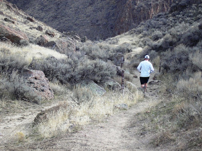
When you reach the top of route you have officially arrived at the trail affectionately known as Bingo! (I still sing the song in my head every time I'm start on this little gem) Bingo is right at the 5 mile mark and for much of the next 5 miles you will be heading downhill. This trail is swoopy and fast and I wasn't sure after falling in love with it on my bike if I would find it as fun on foot, but I can honestly say that now I enjoy running these trails at least as much as biking them and still smile and hoot as I hop off rocks and run my way down through the natural berms that Bingo has to offer. At around the 6 mile mark Mike and I made the observation that he had been packing the camera in his hydration pack for almost an hour and we hadn't taken a single picture.
 (Note: Poop)
 With the requisit posed shot in hand, I took the camera in hand for the remainder of the run so I could snap shots on the fly. This turned out to be great and I managed to grab a few good shots of Mike running and also of the landmark we'd be running into next...


(The shadow in the center of the picture is the beginning of the canyon we headed to next)
At the bottom of Bingo we continued East towards a great little trail called "China Wall." China Wall (and you thought Bingo was a great name) is w600 on the map and it is accessed best via w510 from Bingo. We crossed paths with a couple smiling hikers and then continued down.

(Smiling hikers in distance)
Of all the places I have ran, this section on this particular day could be one of my all-time favorites. At the intersection of w510 and China Wall, the canyon walls stretch straight up and the water cascading down from the upper peaks of the Owyhees echos all around. China wall is named for the lovely trail built quite literally like the actual China Wall. The canyon is short, maybe a mile or two but the trail is so scenic that making a trip to the Owyhees just to do this section would be well worth it.


(The sign says "Trail w510")

 (Looking back on the China Wall, we were on the right hand side of the photo)
After we left the confines of the canyon and the built up wall of a trail, we entered the longest and hardest slog on the entire loop. I affectionately called this section the homestretch because I kept thinking the car would be just up over the next little hill or around the next rock formation. While it is also incredibly scenic, it is a very tough run through loose sand and is just enough uphill that Mike and I stopped to hike some of the ups before resuming our run again on the downs. I have suffered similarly on my bike through this section, but it certainly goes faster on the bike.
Finally, Mike and I rounded a corner and spotted our first sign of civilization. Mike was pretty excited until I told him that we still had to run a bit farther to get to the parking lot we were at. Apparently he didn't notice the first lot on the way in... We caught sight of the car and pulled the plug, walking to cool down the last 100 yards. We were quite sure we had run 13+ miles, but to our disappointment, I mapped the route and found it to be 11 miles. We ran for over 1 hour and 47 minutes and had only stopped to walk some of the steepest, loosest sections. It worked out to be about 9:45/mile pace without factoring in stopping for a few water crossings, pictures, and general look arounds which probably cost us a good 10 minutes of total time. I'm confident that it is the hardest run I have done in the past few years and I'm already looking forward to trying it again in a few weeks. I might just have to talk someone else into going out next time since Mike knows whats coming now...
To view the map of the route click here.
WOW!
ReplyDeleteGreat right up
ReplyDelete